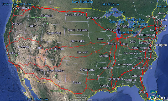
The Amtrak System for Google Earth
The entire Amtrak system represented in Google Earth.
NOTE: This is NOT for use with Google Maps, to use this file you MUST have Google Earth installed on your computer. I am not sure if it will work with the mobile version.
The Amtrak System For Google Earth
To use the program, right click on the link above and click 'Save File As...' and save the file to your computer. Run Google Earth and select File - Open from the menu at the top. Locate the downloaded file and select it to open. The Amtrak Network will appear in your Temporary Places folder. You can then drag it to a permanent folder if you decide you want to save it.
Within the Amtrak System Folder you will find a separate folder for each route Amtrak runs with the exception of the San Juaquin and the Capital Corridor service, because I can't make heads or tails of their schedules.
Within each route folder you will find a Stations folder which contains all of the station stops on the route. Only stations served by trains are included.
Each route has been broken down into manageable route segments, allowing you to explore the routes at your own pace.
For the most part, routes have been followed in the order in which the station stops are listed on the official Amtrak schedule for that line.
Refer to the Tools - Options menu choice in Google Earth to set your touring options to your liking. Here is how mine look.


No comments:
Post a Comment